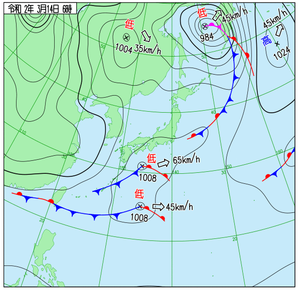
【実況~週明け寒の戻りについて】
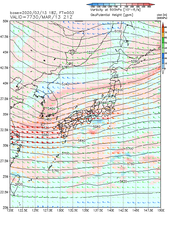
500hPaポイント
(1)黄海の500hPa 5460~5580mには、-30℃以下の寒気を伴うトラフがあって南東進
(2)トラフは14日夜遅くにかけて、西日本から東日本を東進、通過見込み
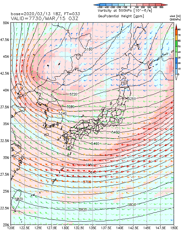
(3)15日夜には500hPa5220~5340m 付近のトラフが日本海に進む
(4)トラフが深まり、500hPaマイナス35度以下の強い寒気が南下
地上のポイント
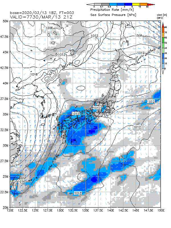
・上記(1)トラフに対応した低気圧が日本の南を東北東進。太平洋側を中心に雨
・上記(3)のトラフの南下に伴い、15 日未明までに日本海に低気圧が発生し、15 日夜にかけて発達しながら日本海を東進する。
・その低気圧が日本の東に抜け、西高東低の冬型気圧配置となる
15日12時トラフ接近
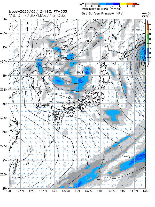
15日12時日本海に低気圧
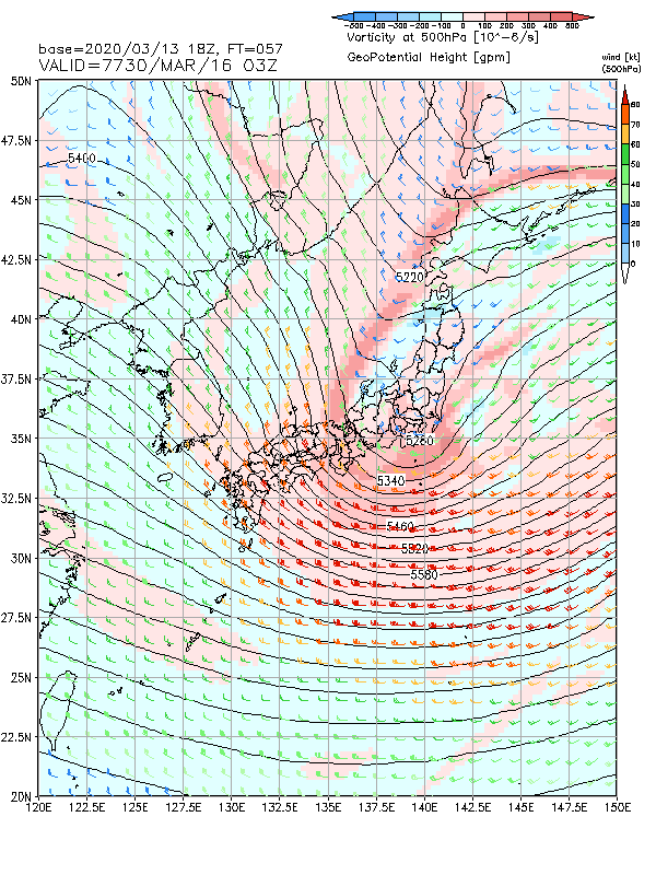
16日12時トラフ深まる
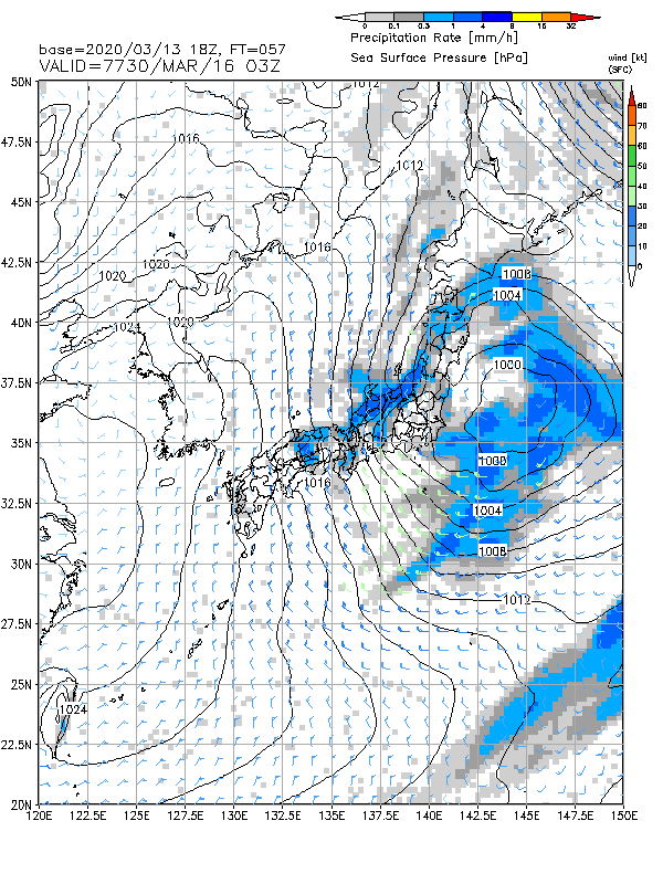
地上は低気圧が東に抜け冬型
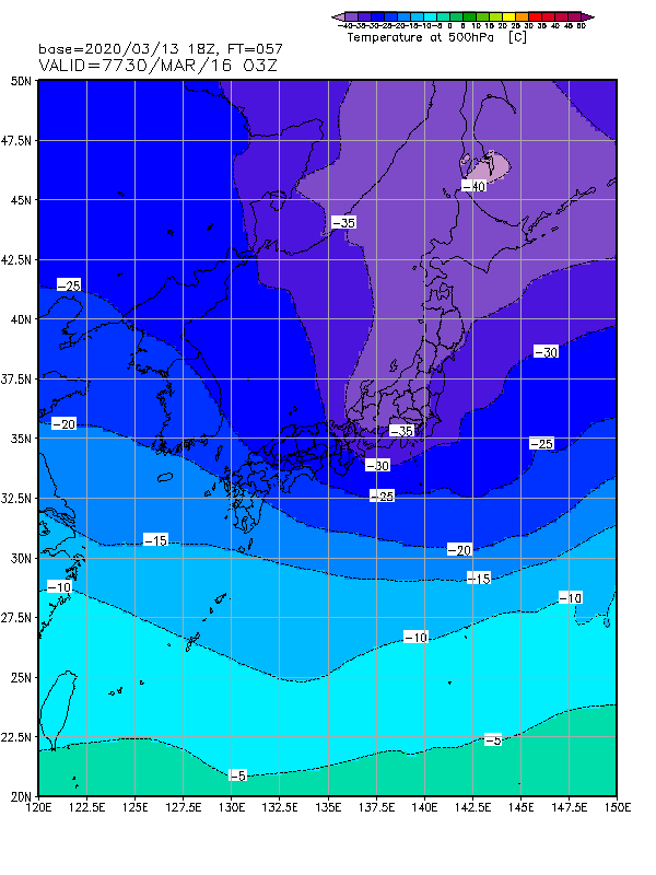
500hPaマイナス35度以下の真冬並みの寒気南下。 大気の状態が不安定となる 。
17日は冬型緩む。
コメント