【実況~明日にかけて】
その前に昨日の振り返り。昨日書いたように、JPCZから延びる雨雲が富山方面へ、そして白馬エリアへ。
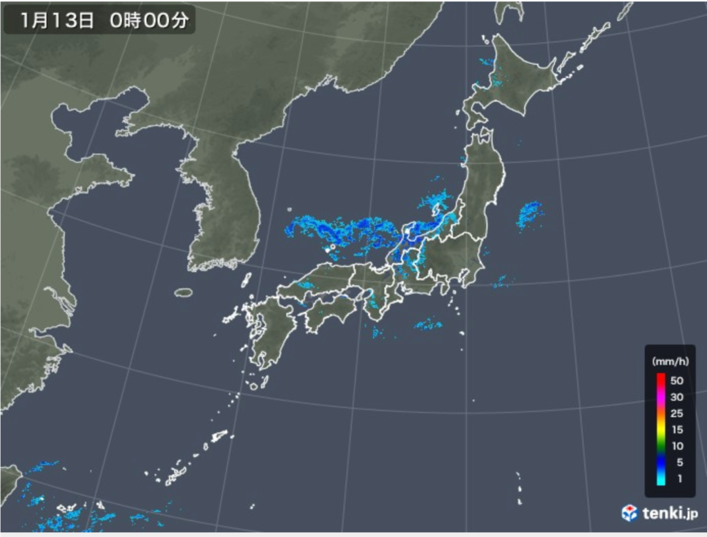
気温が低くないので平地エリアでは雨、山地で雪に。
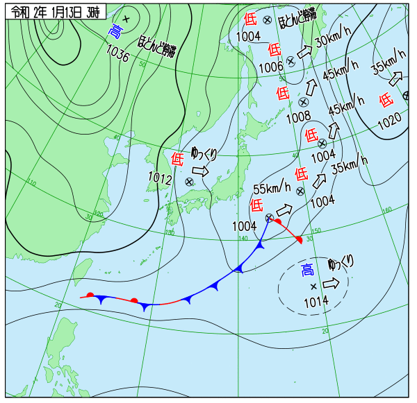
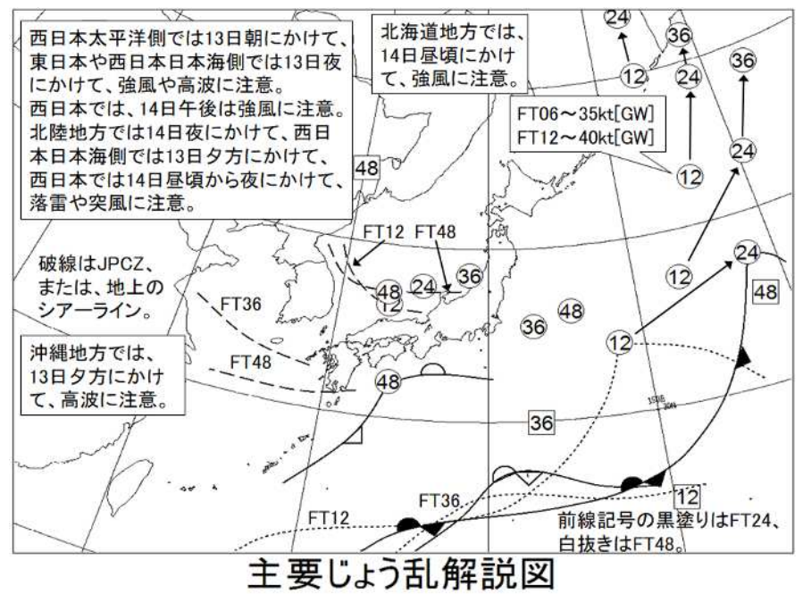
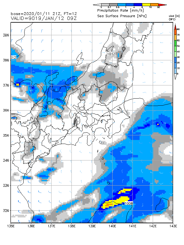
JPCZ 上には、トラフに対応する低気圧があって東南東進。

毎時大気解析。新潟付近の850hPaでマイナス5度。
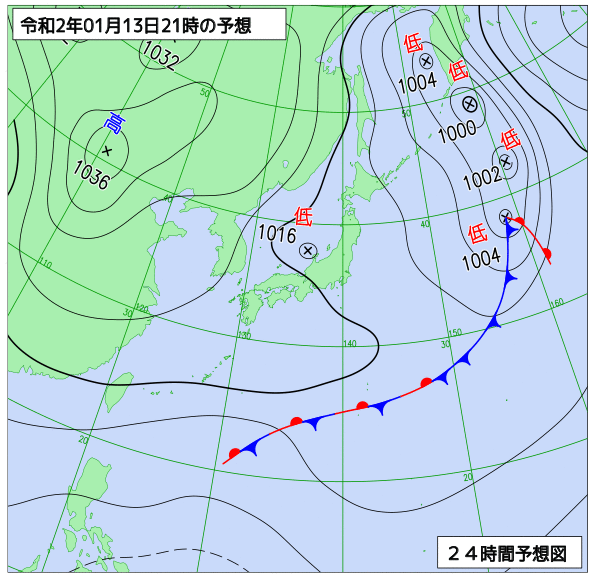
トラフは東進し、13 日朝に東日本を通過する。伊豆諸島付近の低気圧はトラフの接近に伴って発達しながら北東進し、13 日夜には日本のはるか東に達する。日本付近は、13 日は冬型の気圧配置となる。
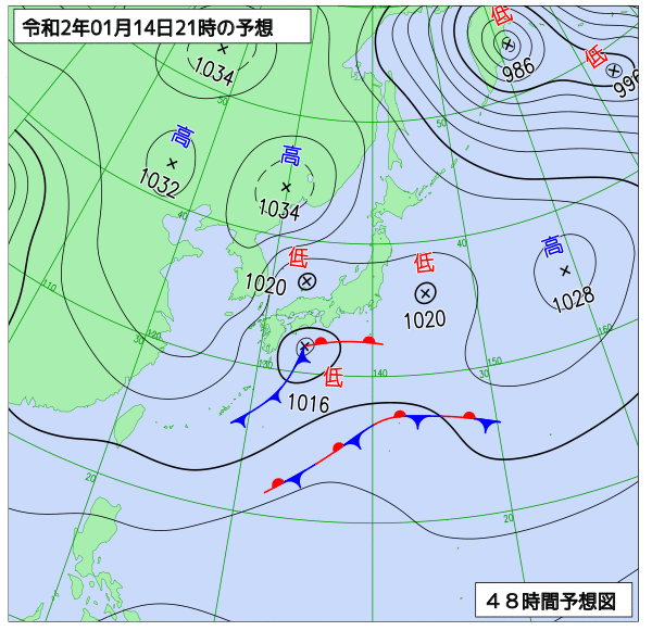
次のトラフが深まりながら東南東進して、14 日夜には寒気を伴って朝鮮半島付近に達する。トラフの接近に伴い、14日夜には、JPCZ 上に別の低気圧が発生して東進する。
14 日夜にはシアーラインの延長線上の四国の南で前線を伴った低気圧が発生して東進する。
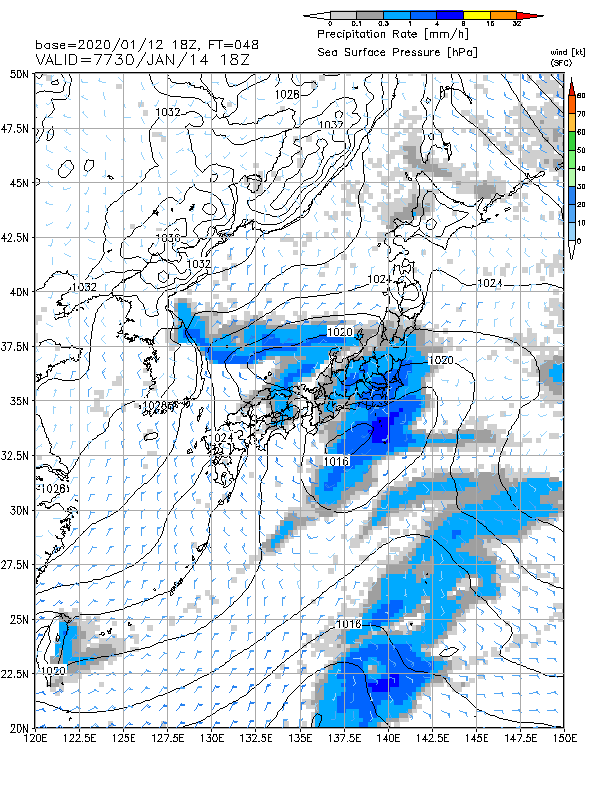
15日3時GSM。その低気圧が関東南岸を通過。あまり発達は見られないが注意が必要か。また日本海にはシアーライン(JPCZ)による降水域が広がる。
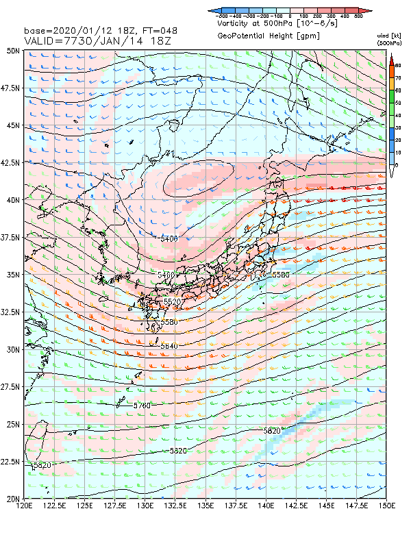
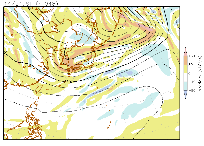
トラフ通過。日本海に寒冷渦。
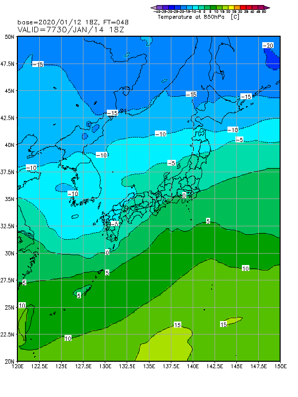
850hPa気温。関東も山地では雪か。
【週間の予想】
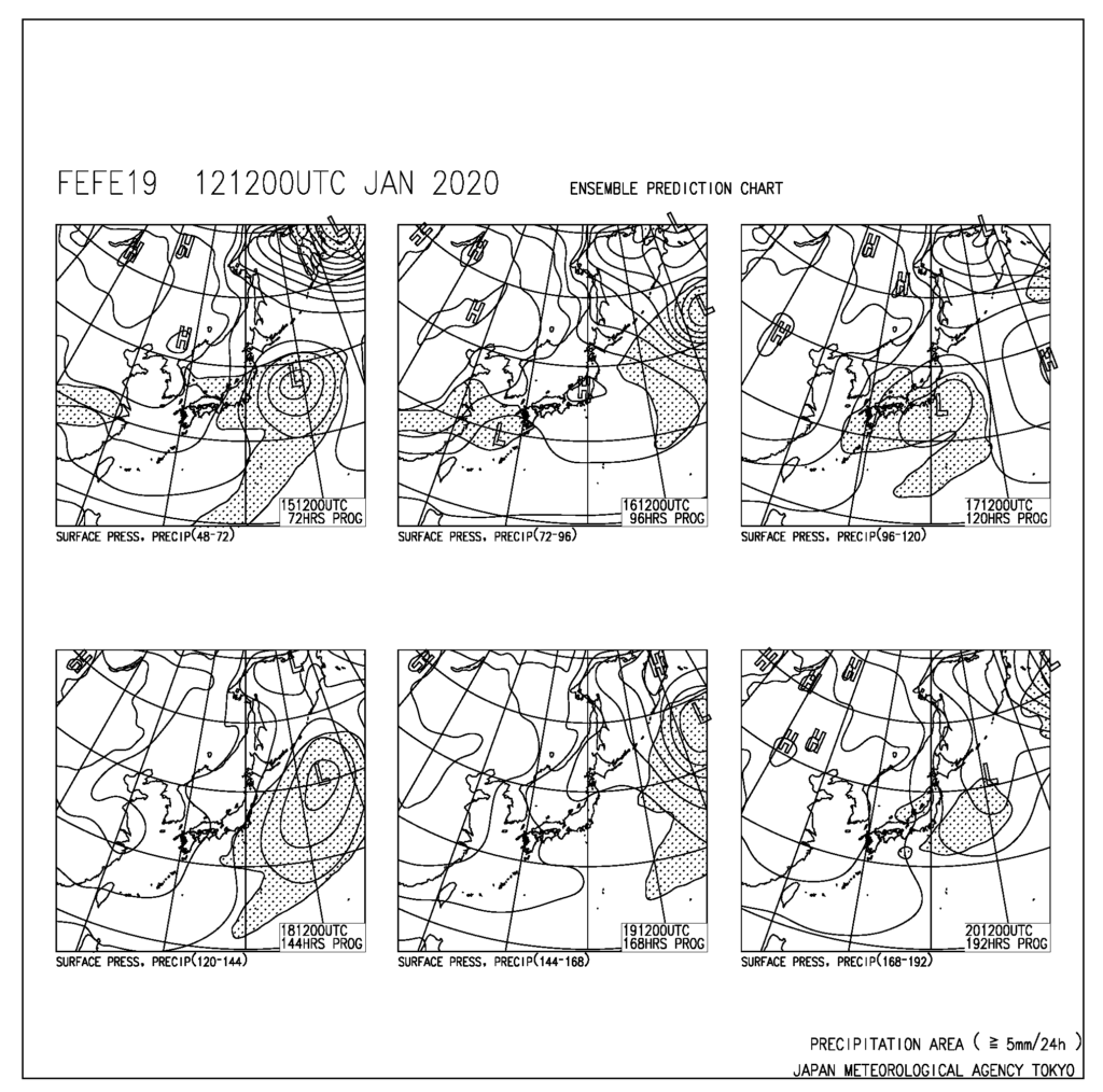
予報期間中は、トラフが次々と日本付近を通過する。地上は、トラフの通過に合わせて、14~15日にかけてと17~18日にかけて本州の南岸付近を低気圧が通過する。低気圧通過後は一時的に冬型の気圧配置となるが長続きしない。
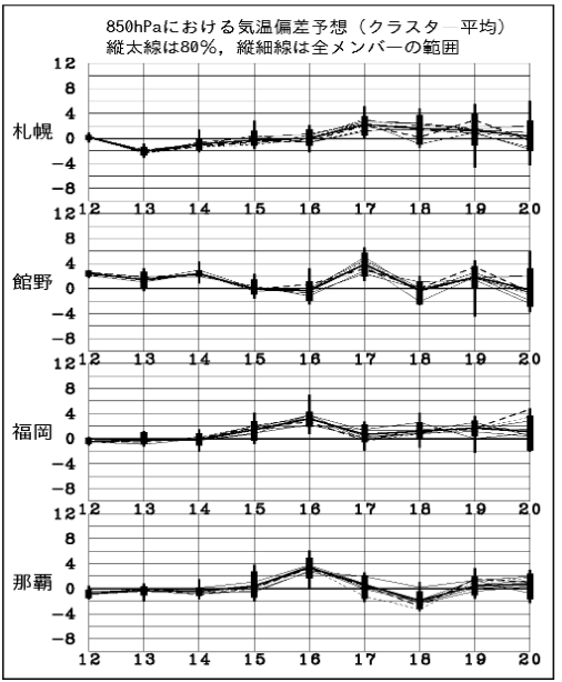
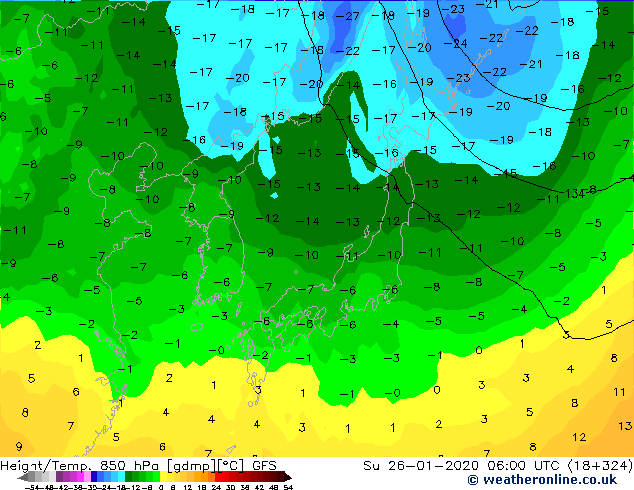
期間を通して平年より気温高め。
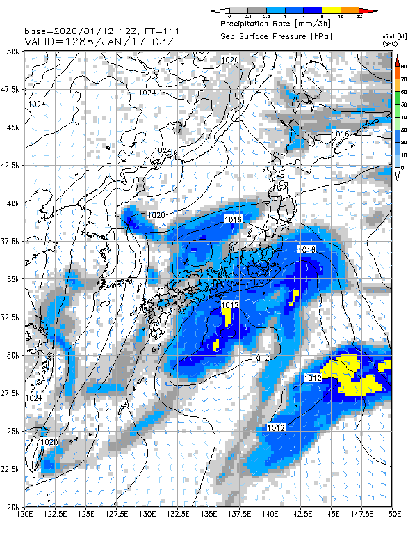
17日の低気圧。
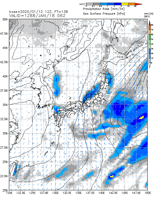
18日、低気圧通過後に一時的な冬型。
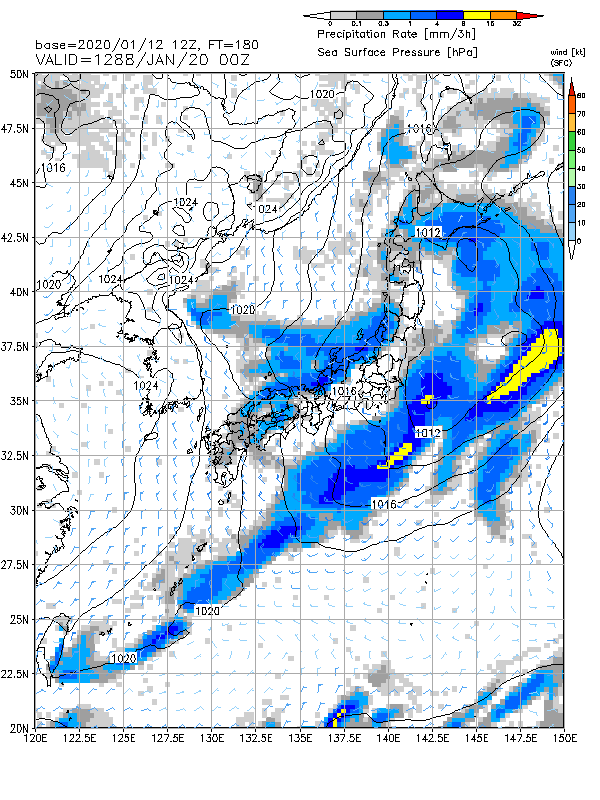
20日、こちらも低気圧が東に抜けたあとに冬型。JPCZによる日本海方面への降水が予想されている。
GFSだと1月の下旬に強めの寒気が予想されている。このあたりを念頭に少し準備しておきたいところ。
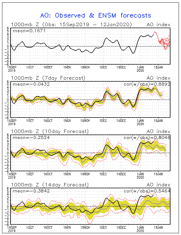
北極振動指数。1月末くらいにAOマイナスに振れてくれるといいのだけど。
コメント