【実況〜明日にかけて】
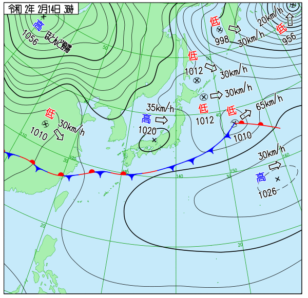
500hPa5760~5820m の正渦度移流に対応して、前線が日本の南 から東シナ海を通り、華中にのびている。華中から華南にかけての 500hPa5700~5760m にトラフが あって東進。
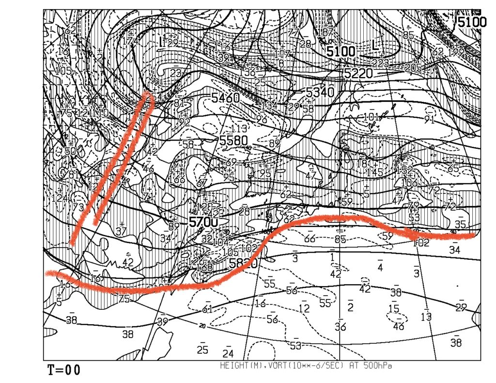
AXFE578から500hPa高度・渦度。
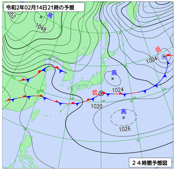
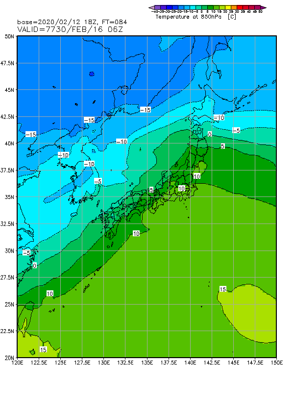
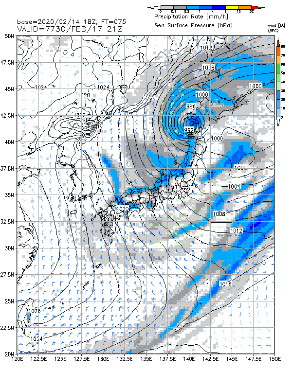
西日本から天気は下り坂に。九州は午前中に雨、関東も夕方には雨に。気温も高く、3月〜4月並みの気温となるところも。
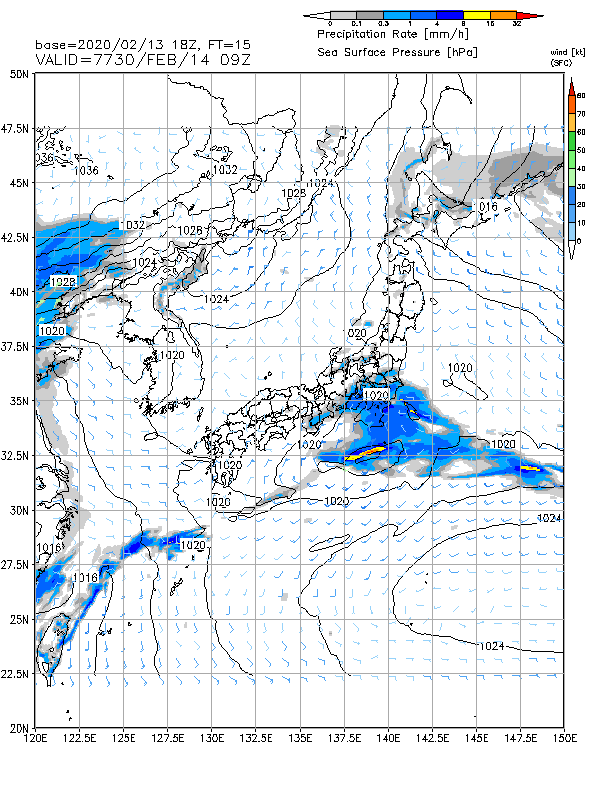
14日18時MSM。
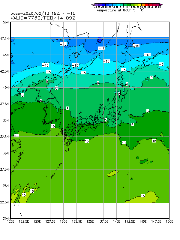
同時刻同モデルの850hPa気温。
【1ヶ月予報について】
昨日は木曜日なので、1ヶ月予報。相変わらず酷い暖冬傾向。
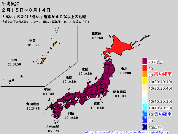
平均気温、高い確率70%以上。赤を超えて紫…
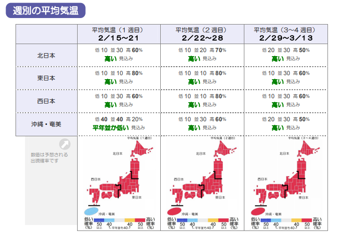
週別に見ても全て高い。
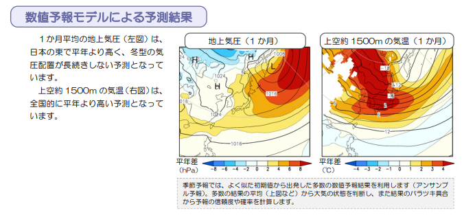
850hPa気温偏差では4度もプラス!!
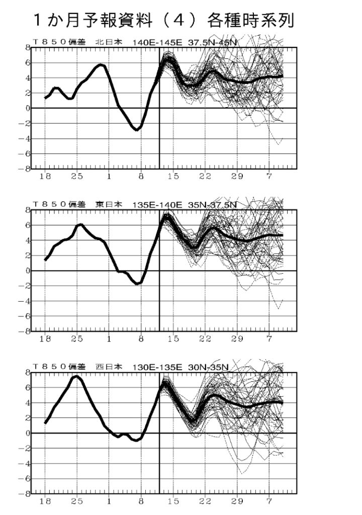
アンサンブルで時系列に見てみる。ほぼ期間中プラス4度以上の見通し。
月末に寒気の放出があるといいのだが…。
3月待たずにクローズに追い込まれるスキー場も出てきそうなそんな1ヶ月予報。
コメント